
MAPS and SIGNAGE
Winter Adventure Guide
The Winter Adventure Guide is one of a series of activity guides I’ve created for Fox Cities Greenways. The goal of these large, foldout maps is to promote and provide information about outdoor activities within the Fox Cities. These guides have been available at local shops and also available online.


Fox River Adventure Guide
The Fox River Adventure Guide is the most recent addition to the activity guide series. It provides detailed information for paddlers on where to launch and how to stay safe on the Fox, in addition to providing an overview of the history of the river and highlights of some of the most interesting features.


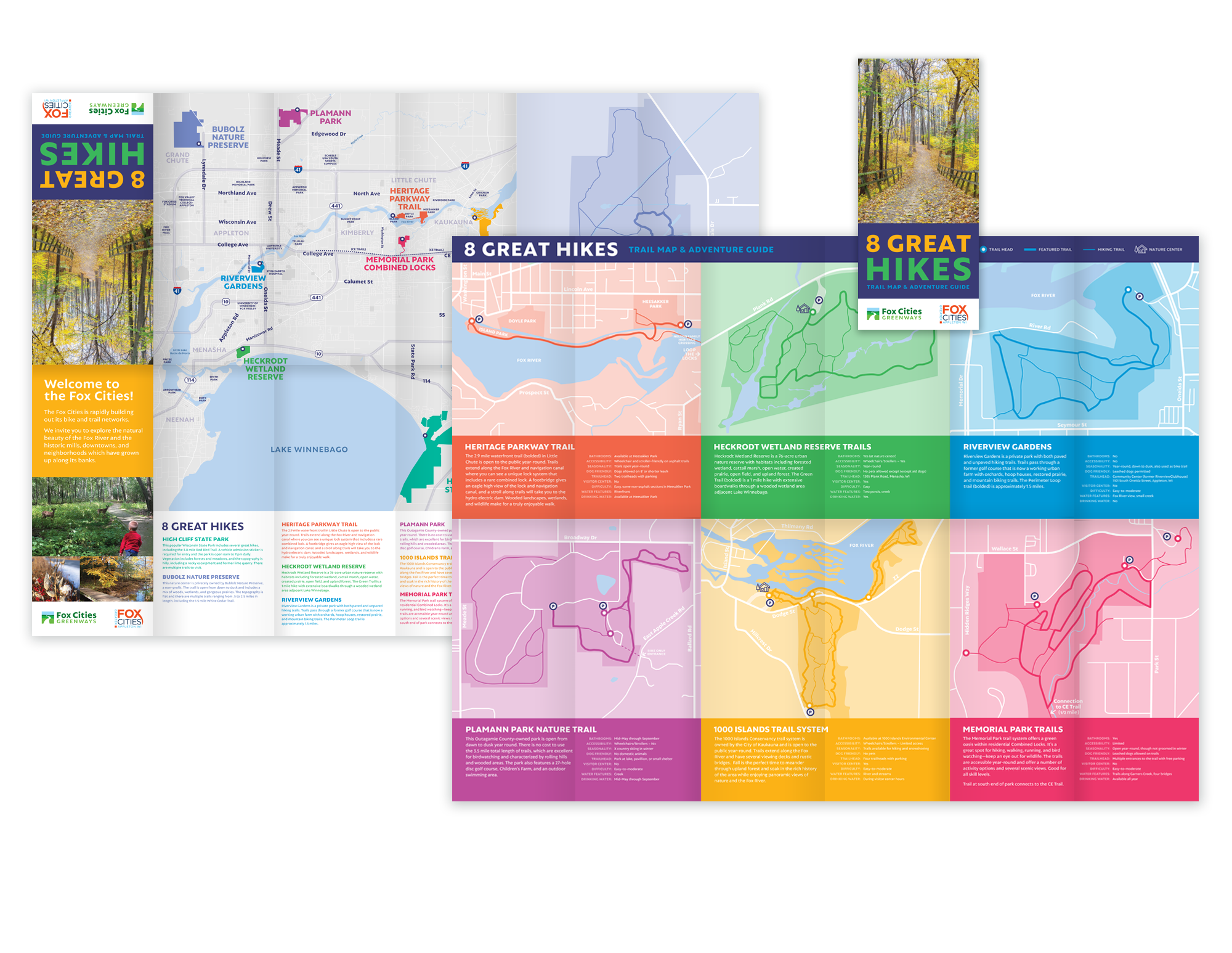
8 Great Hikes Foldout Guide
This is an introductory guide to hiking here in the Fox Cities. Detailed trail maps are placed in the context of the overall metro map, and information regarding difficulty, trail length, and amenities is included.
Disc Golf Course Wayfinding
Winnebago County Community Park disc golfers were having a difficult time navigating the park’s two sprawling courses. I designed the orientation signage and individual hole maps with an emphasis on visibility and clarity. There are 37 maps in total, including the overview map.


NEWT Biking Map
The map and signage here were designed on behalf of North East Wisconsin Trails off-road biking organization for a local state park. This is part of a series of maps and wayfinding signs that will be designed and installed in the coming years.


